How to read a weekend severe weather forecast
This guide shows how to read a severe weather outlook and track hail, wind, and tornado risk.
This guide shows how to read a severe weather outlook and track hail, wind, and tornado risk.
This guide is for developers, weather app builders, and newsroom engineers who need to turn a severe weather report into a clear, actionable alert workflow. By the end, you will know how to identify the main hazards, map the risk areas, and translate a forecast into a user-facing warning or dashboard update.
You will also have a simple process for checking official outlooks, comparing threat levels, and deciding when to escalate notifications for hail, damaging wind, or tornado potential.
Before you start
Get the latest AI news in your inbox
Weekly picks of model releases, tools, and deep dives — no spam, unsubscribe anytime.
No spam. Unsubscribe at any time.
- Access to the NOAA Storm Prediction Center and the National Weather Service.
- A weather data source or API key, such as NOAA feeds, if you are building an app.
- Node 20+ or Python 3.11+ if you want to automate alerts.
- A map tool, such as Leaflet, Mapbox, or Google Maps, for geotargeting risk zones.
- Basic knowledge of severe weather terms: hail, supercell, damaging wind, tornado watch, and tornado warning.
Step 1: Identify the main hazard
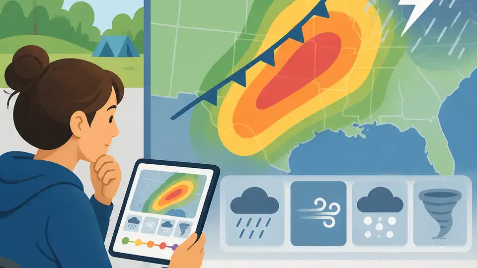
Your first outcome is a hazard summary that says what to watch for before you look at the full forecast. In this case, the primary threats are giant hail, damaging winds, and a smaller tornado risk.
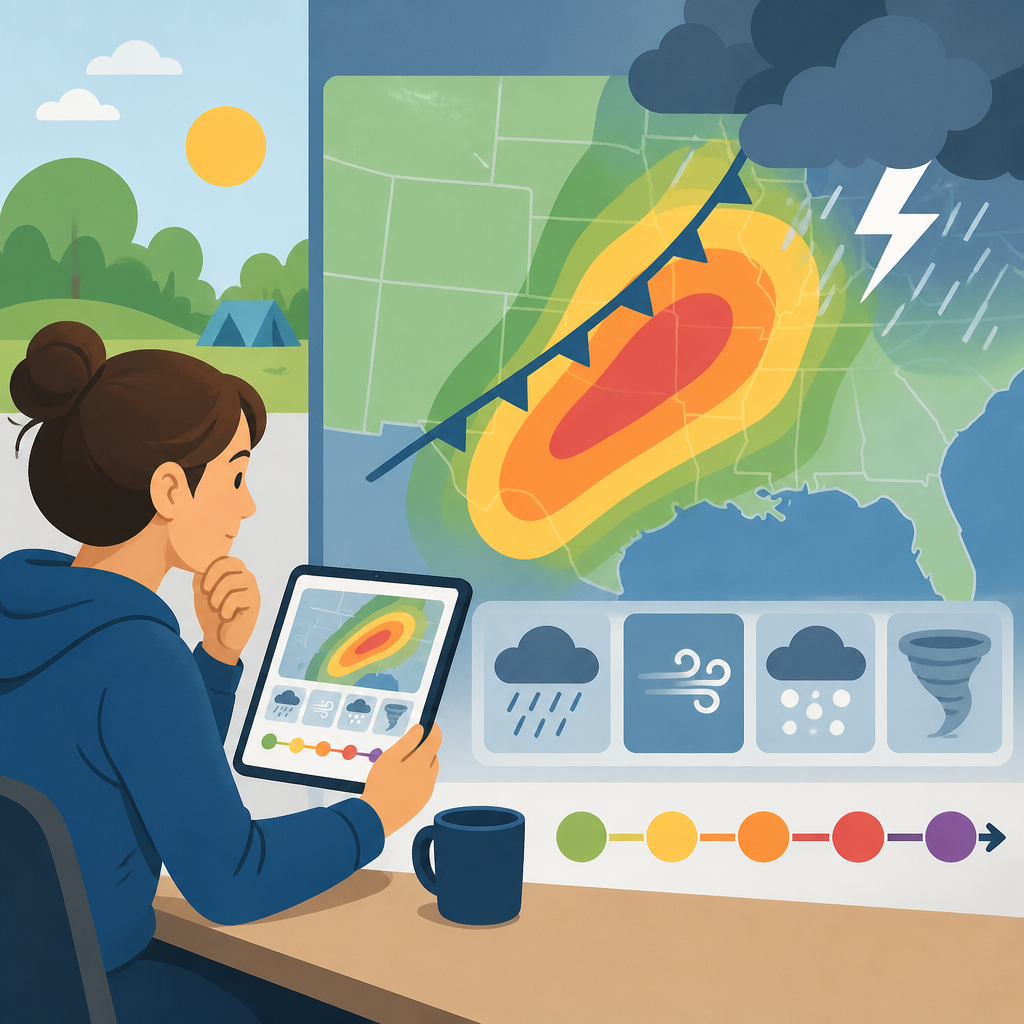
Read the forecast headline and body for the strongest repeated terms. If hail and wind appear most often, those are the lead hazards. If the report also mentions tornado potential, treat that as a secondary but urgent risk.
Verification: you should see a concise statement such as “hail and damaging winds are the main threats, with some tornado risk.”
Step 2: Map the risk area
Your next outcome is a geographic view that shows where the threat is strongest and where it spreads next. The forecast covers a broad corridor across the Central U.S., with higher concern in Nebraska, Kansas, Iowa, and nearby states.
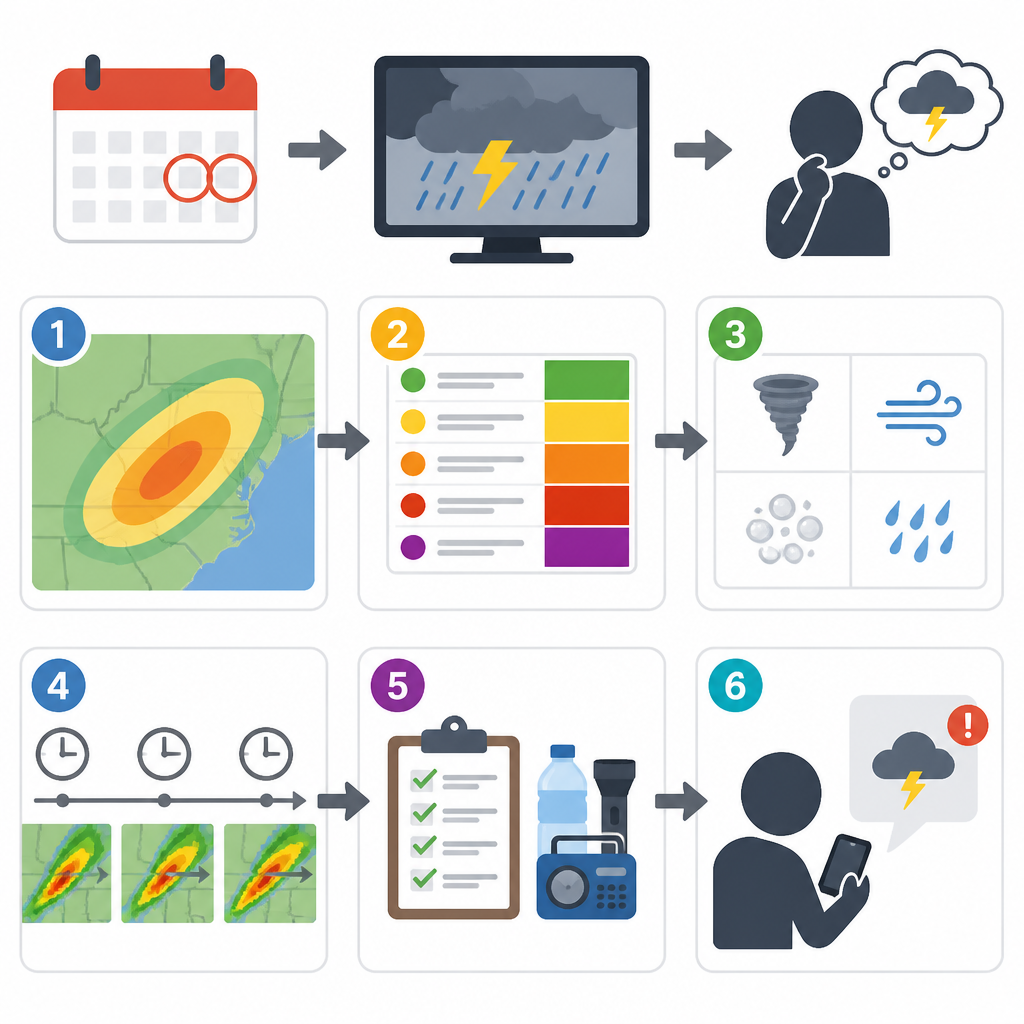
Use the outlook area to tag states, counties, or cities in your system. If you are building alerts, group users by location and assign a severity label based on whether they fall inside the enhanced threat zone or the broader watch area.
Verification: you should see a map or location list that separates the higher-risk zone from the wider regional threat.
Step 3: Translate threat levels into user actions
Your outcome here is a severity ladder that turns meteorology into product logic. The article references level 3 of 5 and level 2 of 5 outlooks, which means some areas need stronger messaging than others.
Use a simple rule set: level 2 means monitor and prepare, level 3 means warn and check shelter options, and any tornado mention should trigger a higher-priority alert. If you are writing copy, keep the message specific: destructive hail, 65 mph-plus wind, and possible tornadoes.
if threat_level >= 3 then alert = // Related Articles
- [IND]
Severe Storms Threaten the Central U.S. Tonight
- [IND]
4 clues in the Jayson Tatum rumor
- [IND]
5 signs Ella Mai and Jayson Tatum fans saw
- [IND]
5 ways AI models are getting too risky
- [IND]
Celebrities pack NHL playoff arenas in 2026
- [IND]
Why Footwear News still matters in a sneaker-first market